Monday, July 17, 2017

North City Ramble

Last Wednesday I'd arranged for the kids to spend and afternoon at their friend Hanna's. She lives on the northernmost edge of town - probably as far as you can go from our place and still remain within the city limits. I decided after riding up to Hanna's with them, I'd carry on North of the city to explore a bit, as I've never been up that way before. 

Hanna's place was 12Km from our place - so the kids got in a 24Km ride themselves just going to her place and back.


One of the things I'd planned to check out what the North Commuter Parkway Bridge which is currently under construction. I wonder if there are cycling trails being built (or at least PLANNED) and a pedestrian/cycling walkway - or if it will later be tacked on as an afterthought?


Big sign along the Meewasin Trail about the North Commuter Parkway project. 

This area - much like Sutherland Beach across the river was once used for Mountain Bike races, but like Sutherland Beach this has now been designated an "Off Leash Area" for dogs and Mountain Bikes are not-so-welcome here anymore.


Beyond the dog park I hooked up with the cycle path that follows Wanuskewin Road. 


Wanuskewin Road and Marquis Drive looking west (which is often pronounced Mar-Kwiss around here...). marquis Drive is what the North Commuter Parkway will feed into. 


Wanuskewin Road and Marquis Drive looking east towards the new bridge. 


Just a little further along I came across AkzoNobel Chemicals - where Amanda had worked I think the summer after we met over 20 years ago. She was still doing her Toxicology program at the U of S and was hired to do... something with air quality monitoring... I think...? It was a long time ago. And she rode her bike up here everyday all summer long - and I'm pretty sure that was way before this bike path was built!? 


Just past 71st street, just before leaving the city limits the path turns to a gravel (or crusher rock dust?) trail in the ditch. While that sounds rather ignominious, it was a really nice little ride - separated from the road which sees some pretty heavy traffic. 


Being kind of in the ditch I wondered what it might be like in heavy rain - or in the winter..? But the warm, sunny, dry day I was out there it was just lovely. 


Busy road on one side... field on the other. 


I knew the path went all the way to Wanuskewin Heritage Park, and had assumed it followed the road all the way there. It did not. While the road takes you north of the park and enters the park from that direction, the trail cuts between two fields and enters the park from the south! 


South entrance to the Park. 


I've never actually BEEN to Wanuskewin Heritage Park - at least, not since the built the PARK and interpretive centre. I did come out here many, many years ago when to the archaeological dig at the buffalo jump as part of a summer program at the university my parents put me in when I was in grade school. 


The interpretive centre. 

I really should come out here with the kids sometime. 

From here I rolled out the main gate of the park heading North. 


Looking back towards the park from just beyond the north gate. 


Just beyond the north gate - heading east now - I rolled through this little gully and briefly got hopeful that the road might have lots of scenic gully to roll through. 


No such luck... beyond that the rest of my ride was extremely flat-ish. 


Looking back west. 


Eventually the road bent around North-ish, following the river, which brought me to Cathedral Bluffs - a development of huge freaking homes just north of the city. I turned up a newer road which wound through a newer part of the development. 


Many of the lots are undeveloped - other than the overgrown gate pillars marking the entrance to the lots - and still for sale. 


There is a lot still for sale between these two houses - if you look carefully you can see a little wooden platform with stairs leading up to it. There were a few of these on the for sale parcels of land - presumably for prospective buyers to climb up and get a sense of the view they will have from their future ostentatious monstrosity of a home.... I was tempted to ride out to one and climb up to have a look... but then decided not to. 


The more developed (older) properties were usually surrounded with trees and nicely landscaped. So much lawn to mow!? This one had a nice etched stone at it's entrance. I thought of taking pictures of some of the homes... but then... just didn't care to. There just big ol' homes... 


The pavement ended at this t-intersection. There I turned left (onto Township Road 382) and headed back West. 


Gravel. 


Sign post at intersection. 


More gravel. 


Parts were particularly loose so I stuck to the shoulder, which was luckily pretty well packed and solid. 


At this intersection I turned south again (onto Range Road 3050). 


Heading South again. Fines for littering, huh? Like, just on THIS road...? 


Nothing out here but fields of Canola and the sky...


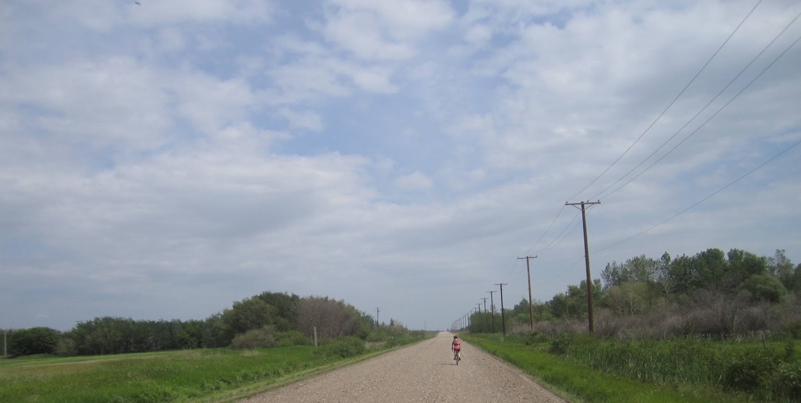
Well... fields of Canola, the sky, and The ROAD stretching off to the horizon...


Well.. fields of Canola, the sky, the road, and the occasional building or pump house.... and piles of garbage dumped in the ditch...?! Seriously? 


Eventually the road brought me back to Penner road (Township Raod 380), which I had left Wanuskewin on. 


On the little post across the intersection there was a little sign tacked to it indicating the road I'd just rolled up was part of the TransCanada Trail...? 


along Penner road... Why would a field of Canola need to be under video surveillance? 


Back through the pretty gully which I stopped and took a picture of (instead of trying togged maximum speed going down into it to have enough momentum to carry me up to the other side - as I'd done coming the other way). 


Scots Thistle near Wanuskewin. 


The pathway out to Wanuskewin seems quite well used. 


Back to Wanuskewin Road and the parallel bike path in the ditch. 


and back to the dog park just east of Hanna's 

I didn't pick up the kids on my return trip. I instead headed for home so they could have a few more hours there. 

When I got home there was a message that my new handlebars for the Karate Monkey were in, so I nipped out to get those!

The kids phoned just before supper time, as we'd planned, and I headed out to meet them. Actually they phoned a bit LATER than we'd actually planned and left even later and/or rode slower as I met them more than halfway to Hanna's... and we got home really late... and hungry.... 

Total riding for the day: 70.91Km. Not the longest ride I've ever been on by far... but I'm working back up to it. It's been a long time since I've done that sort of distance in a day. 


Gravel

Last Monday (10 July 2017) there had been a thunderstorm overnight, so we decided to give the trails a miss and head out on for a ride on some gravel roads Southwest of town.


My Salsa Fargo which I bought off a friend earlier this year - with a fancy new rear rack and a trunk bag from Arkel which I picked up more recently.


I also got this "Take-a-Look" mirror in the mail the week before and was interested to try it out.


Heading out of town on our "Gravel Bikes". The Girl is riding the Kona Jake 24 we picked up for Finnegan to use as a road bike a couple of years ago. Finnegan's riding Amanda's old Soma Cross Bike which I have set up for gravel riding with some Clement 700x40 X'plor MSO tires.


The first part of the ride is pavement - heading out Spadina Crescent south towards Valley Road.


But once we cross Valley Road onto Township Road 362, it's all gravel. Loose, washboardy gravel.


So washboardy the kids were hugging the shoulder most of the time, which was at time soft and sandy, but still better than the washboard in the middle of the road.


Turning North onto Range Road 3062 we found it was in the process of being graded.


We stopped briefly at the Chappell Marsh Conservation Area for snacks and drinks and checking blood-sugar levels...


While we were there, we spotted a hawk floating in the air above us. It was being harassed by swarms of little birds - swallows and red-winged blackbirds - at least a half dozen of each! the Swallows were diving and nipping at it!


From there we headed east through Cedar Villa Estates and beyond. Clouds rolling from the west bringing another afternoon thunderstorm. I figured we'd easily be back before rain started falling... but we did bring along jackets - just in case!


We circled back to Township Road 362 and started heading east - back towards home on it. Rolled past another little wetland... with an old television dumped in it!? What is wrong with people!?


What set of pictures of a Saskatchewan countryside is complete without one of a dilapidated old abandoned building.


Heading back east we were turning into a pretty brutal headwind... Clouds rolling in from the west... but the wind on the ground was gusting to 40kph out of the east? I expected at least a bit of whining or complaining out of The Girl, but she just rode off into it. She had seen a deer cross the road just as we turned into the wind and was so excited about that that she barely noticed the headwind all the way home!?


Back hugging the shoulders again to avoid the loose, washboardy centre.


back on the pavement - the wind so strong at this point the kids couldn't even get some good speed up going down this hill.


Eventually we turned North to head back into town and the trees between the river and the road shielded us from the wind.


Over the weekend I'd done a fair bit of cleaning and organizing out in the garage (I've done even more since, but still have a long way to go!) and at least cleared enough space I could get a few of these new bikes hung up...

In Search of New Trails

On the 7th we decided to break out of our regular routine (if a few rides so far this summer can be considered a "routine") and, instead of riding our normal trails to the South, we decided to check out the trails on the east side of the river NORTH of where we live.


Sneaking around construction of the new Traffic Bridge.


The New Traffic Bridge. It'll be nice if this ever opens... I wonder if it will be this year or next year...?  How long have they been working on it. The original took less than a year to build. There was probably over a hundred people working on the original - man-handling all that steel into place. Now, whenever I pass this site, there are maybe a dozen guys working on the site at any given time.


Pedestrian crossing sign someone was modifying - perhaps they were in the process of modifying it when they were scared off. I'm guessing that little line above his head is the beginning of a beret that didn't get finished before the "artist" was obliged to abandon their work.


We entered the trail under the Broadway Bridge - a trail I have ridden many, MANY times before... but not in the last decade... It was much as I recalled it, thought a little overgrown.


Unfortunately we couldn't get through the University Bridge (or beyond - at least on this trail).


a fair section of the trail has been destroyed by one of the riverbank slumps that have taken place over the last decade or so, and has yet to be reestablished...


I'd considered carrying the bikes across... but not knowing the state of the trail on the other side, I decided we should head back and I would do some further scouting on my own at a later date.


Luckily we didn't have to ride all the way back to the Broadway Bridge, there was another sure trail we were able to climb up and out to the main Meewasin Valley Trail and from there continue North to  the University Bridge.


North of the University Bridge we rejoined the single track in the brush along the riverbank.


A lot of is is very close to the river's edge.


Climbing up from the river's edge a bit.


Big damned Pelican flying overhead. Actually it looks kind of small in the picture. Trust me, it was a big damned bird!


Flying away to join the other Pelicans by the weir.


Stopped briefly to discuss what the possible use of this apparatus could have been. (It was part of a lift for a riverside ski jump!)


Stopped in the shade near the weir for snacks and water. The Girl was pretty much out of water and getting excessively warm, had a headache and was very tired, so we called it a day and decided to head back.


... after briefly reconnoitring the trails ahead to see where they lead off to after the weir.


After the steep climb up from the weir to the paved Meewasin Trail I waited for the kids by a bench - and noticed it was a memorial bench for Karen Shank - a childhood friend who died as a result of injuries sustained in a traffic collision a few years back. (I believe she was rear-ended, transported to hospital, but the released. Later in the evening she started speaking incoherently and an ambulance was called for her. On the way to the hospital she slipped into a coma and never woke up).


2005... wow... I can't believe it's been 12 years!


Stopped to read about the old Varsity Ski Jump before heading home. I wonder if they landed on the river!? I know the river level dropped considerably during winters and completely froze over in the days before the weir was built... but the ski jump was apparently still in operation until 1971 - thirty years after the weir was completed...


MORE Trail Rides

I've been having some problems with my ten and a half year old iMac - it seems it's finally giving up the ghost. So I'm now just getting caught up with posting come pictures. 


I took during rides over the last few weeks. These pictures were taken on a ride we went on 6 July 2017 - just a day after our previous ride. We rode pretty much the same trails east side of the river, south of our place.


Kids eyeing up their nemesis - the steepish slope that is the entrance to G2 - for some reason they just can't seem to get the momentum to get up this slope.


Finnegan had a go at riding down the little ramp at the beginning of this part of the trail. It's not a particularly challenging line, but he's not much of a balls-to-the-wall-kamakaze-daredevil and this was pushing his boundaries, so...


The Girl had a look, but decided it was still a little too far beyond HER boundaries...


...so she took the adjacent "Chicken Route".


On our way back we explored some new (to us!) trails in Diefenbaker Park - In some spots we stopped and scouted ahead on foot to see if a section branding off was ridable.


The Girl descending one of the ridable sections.


We mixed up the technical trails on the steeper treed sections of the river banks with some easier paths right down by the water.


Back into the trees.


Finnegan following along.


and back to the river's edge.


We need to get Amanda back out on HER bike one of these days...